
The last leg of my journey on Route 66 was from Gallup to Albuquerque. The is a lot to see on this leg, but I rushed to meet The Amazing Ms. D,who was flying in to Albuquerque for a writers workshop. Therefore I only had time for one thing. I chose El Malpais National Conservation Area (here).
El Malpais
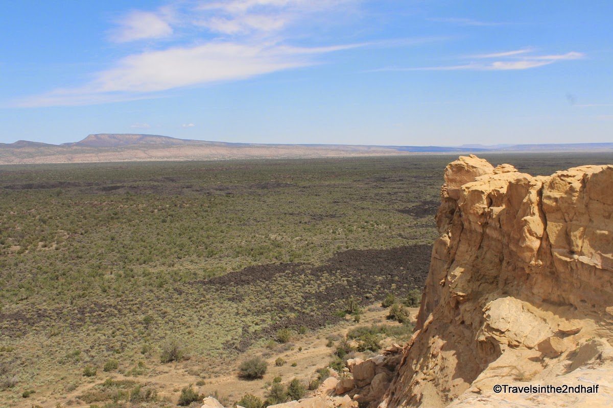
El Malpais (literally - The Bad Lands) sits to the south of Grants NM. It is large area of basalt rock from the lava flows of many volcano eruptions around 3 million years ago. Lava flows fill a rift valley that stretches between the Zuni and Acoma Pueblos. The valley sits between large sandstone bluffs, several hundred feet tall.
Looking out over the valley from the Sandstone Bluffs you can see how the lava flow filled up the entire valley.
|
The black areas are the basalt from the lava flow |

|
The sandstone forms a sharp contrast to the valley below |
|
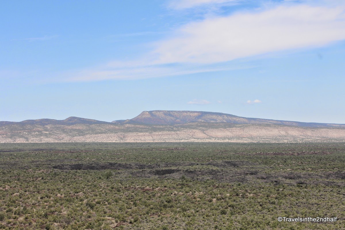
Mt Taylor - The source of the lava |
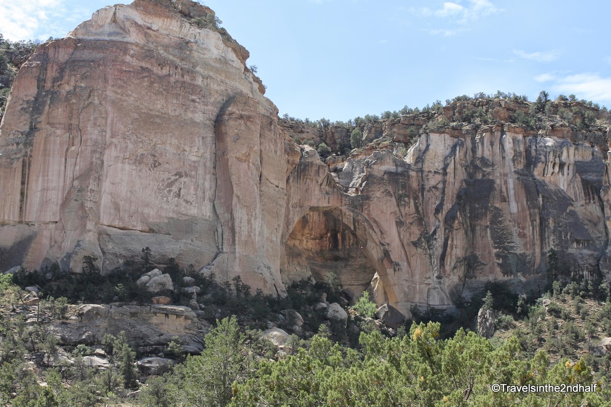
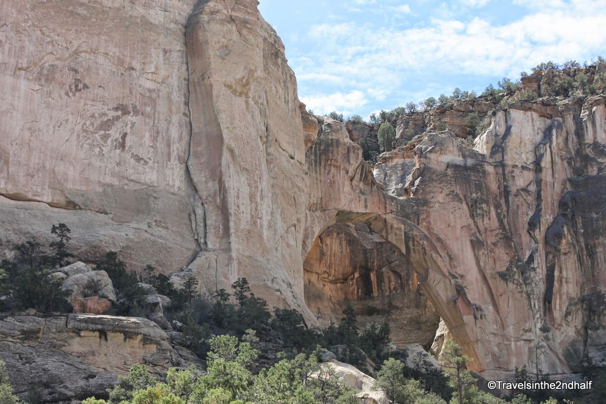
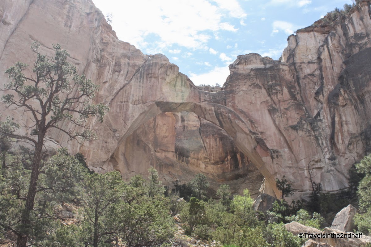
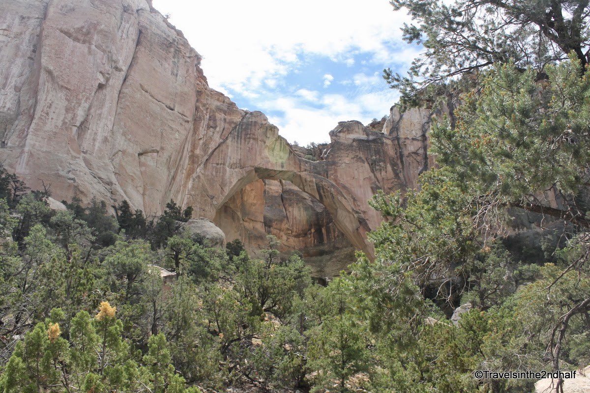
The Malpais NCA is also the home to larges natural bridge in the United States - La Ventana
|
La Ventana from the parking area |

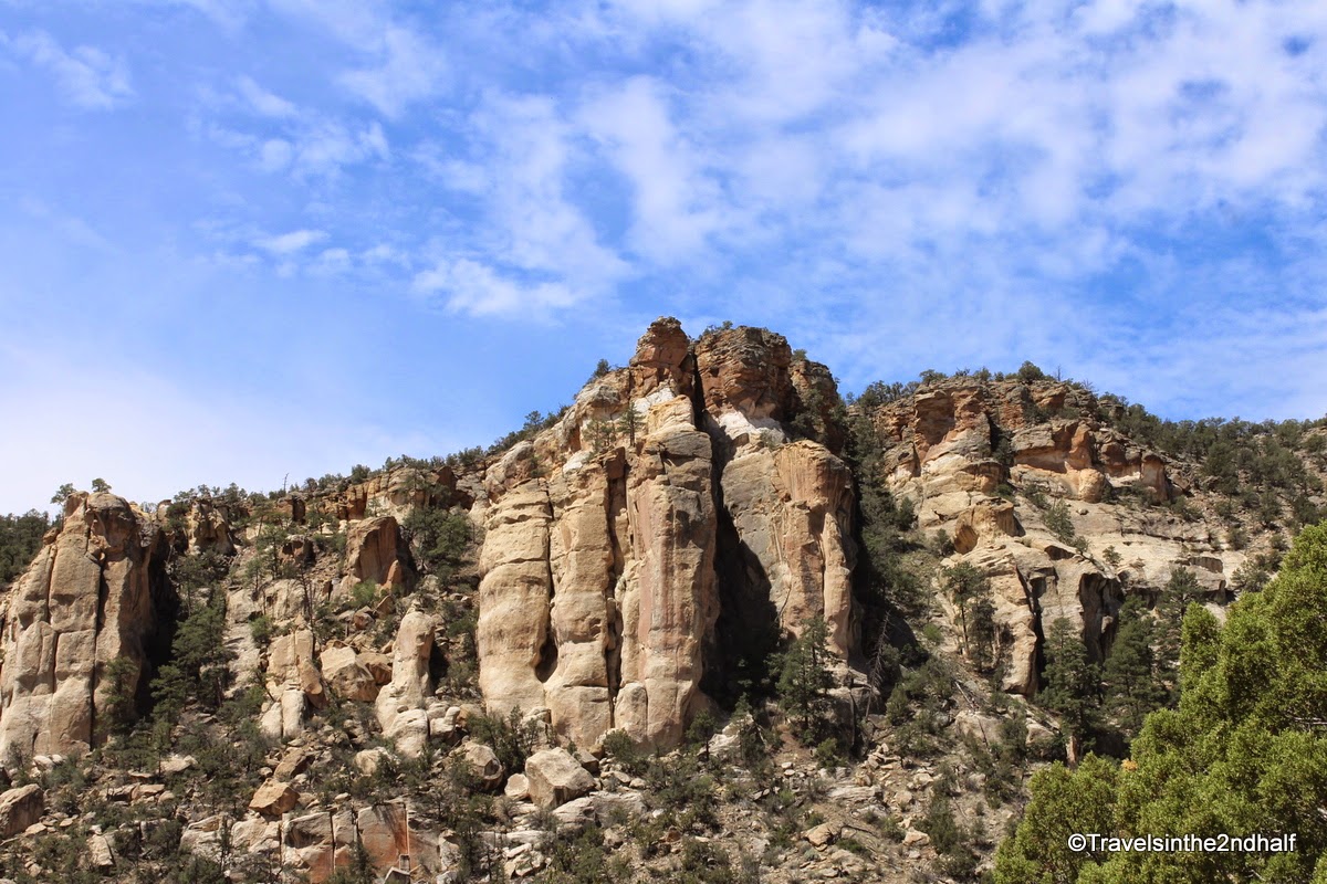
One of the beautiful things about sandstone is the way it erodes due to weather. The formations are amazing


This section of Route 66 is largely gone, replaced by Interstate 40. It is a pretty straight drag into Albuquerque. The highway sits in a valley between more sandstone bluffs almost all the way. The bluffs end as you come down a hill and cross the Rio Grande River.
Comments (1)