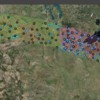
Like many of us, Shane Loeffler was looking out an airplane window admiring the scenery as he was flying home to Minnesota from the United Kingdom. Beneath him the geology student studied the glaciated rock formations of the Canadian Shield, and an idea sparked in his mind. What if there was a guide to show fliers exactly what they’re seeing thousands of feet below?
With the aid of a grant from the National Science Foundation, Loeffler was on his way to developing this guide. His app, Flyover Country, is now available for free download.
Flyover Country uses maps and data from various geological and paleontological databases. These give information about the landscape you're flying over. The user will see features tagged on a map corresponding to the ground below. To explain the features the app relies on cached Wikipedia articles. Since it works with a phone’s GPS, there’s no need for in-flight wifi. You can just peer out your window and learn about natural features, like rivers and mountains, or man-made features, such as mines and dams, and read Wikipedia articles about them at the same time.
And this is just the beginning. Loeffler's team hopes scientists doing field work will be able to upload their findings, creating a current, ever expanding database. It's a great way to get your information out and to educate the public about our planet.
More on this story from the Smithsonian.com at this link. I haven't tried the app yet, but hope to on my next flight.


Comments (0)