
El Morro National Monument
On a drive from Taos to LA I was able to stop at El Morro National Monument. https://www.google.com/maps/place/El+Morro+National+Monument/@35.038333,-108.353333,9z/data=!4m2!3m1!1s0x87246612f2207dd3:0xad3ac144c60b50d8?hl=en
El Morro is about 70 miles south east of Gallup. This is an oasis on the trail through the desert. It has been named a National Monument as a place that played an important role throughout the history of the Americas, from Native tribes 1000 years ago, to the Conquistadors and the Spanish settlers of the 1600/1700's and on to the survey crews for the Union Pacific Railroad. A natural watering hole at the base of the sand stone bluffs. It was reliably full all year long. And so it became a home or stop along the road.
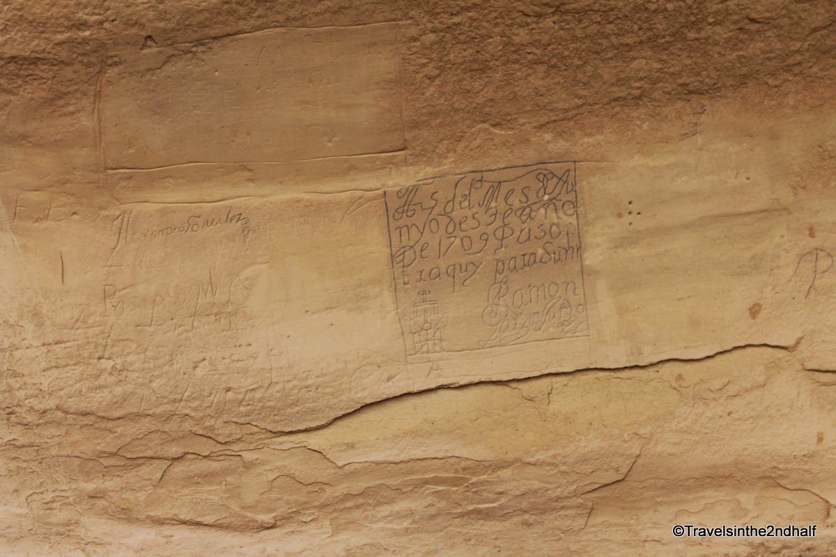
It also became a place where people left their mark. Along the sandstone cliffs are petroglyphs from the Pueblo people who lived at the top of the cliff. Spanish Conquistadors carved their names into the rock before the Pilgrims landed at Plymouth Rock. Survey crews for the railroad used official stamps to place their names into the rock. For all of this history El Morro has been named a national Monument. It is a monument to the history of area and how the many peoples of this land have passed through and, in that most human emotion, left evidence that "Gilroy was here".
There are 2 hikes at El Morro. The hike to the wall to see the pond and the inscriptions is a fairly easy 0.5 mile round trip on paved paths. There is a little elevation change (about 20m) but nothing really rough. There is also a 3 mile hike to the top of the cliffs which includes the excavations of the Pueblo.
 |
| The pond at El Morro |
 |
| The running water has left mineral deposits on the sandstone |
 |
| El Morro |
 |
The bluffs are sand stone, which means the weather has brought about erosion in some beautiful patterns:
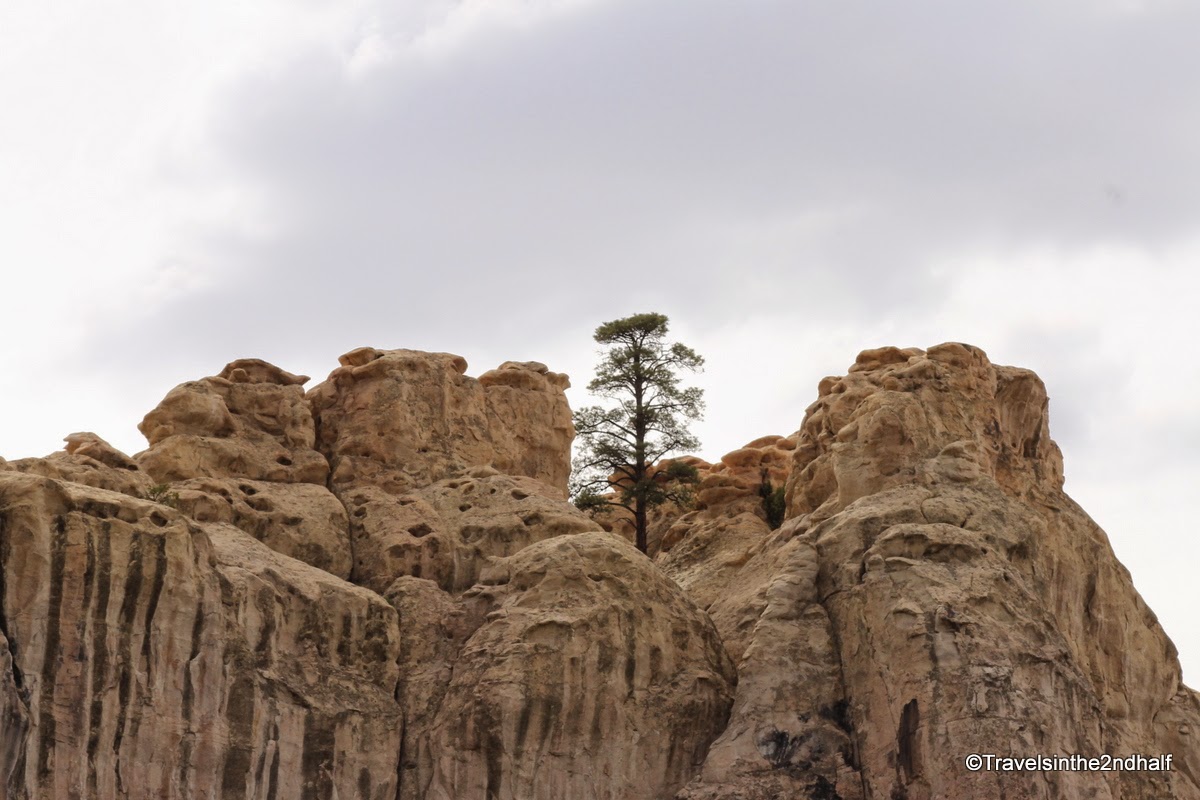 |
| Pine tree at the top of the bluff, I love the corrugation effect |
 |
| This looks like small stones piled on large ones |
 |
| The cliff face through the juniper trees |
 |
| This looks like,,,,well you can figure it out |
 |
| Do you see the face? |
Because this was such a reliable water source, this was a major stop for travelers for centuries
 |
| Ruins of a native village at the top of the cliff |
 |
| petroglyphs at the bottom of the cliff |
 |
| More petroglyphs |
 |
| Big horn sheep are native to this area |
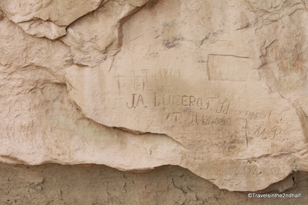
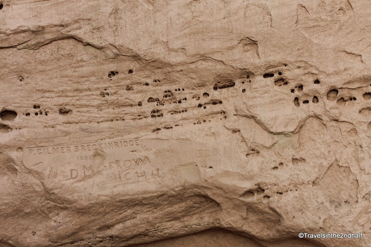
The wall of the cliff also gave way to man oldest preoccupation - letting people know he was there. That's right, graffiti.

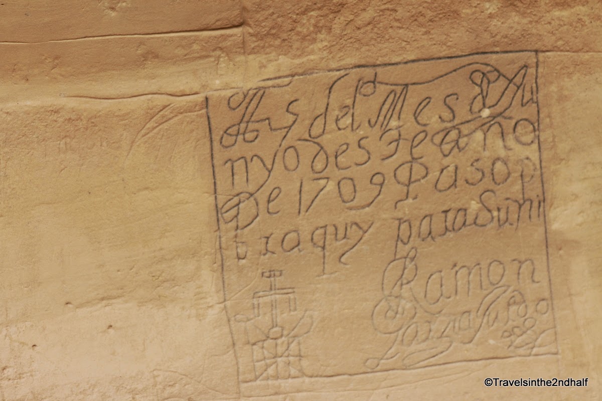

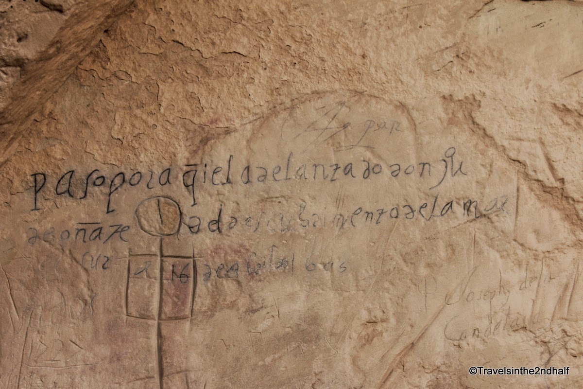
Comments (2)